Scientists Study How Rising Seas Will Reshape Georgia Coast
Scientists are fine-tuning what they know about rivers and marshes flushed with saltwater by ocean tides so they can better predict how rising sea levels will reshape the Georgia coast over the next century.
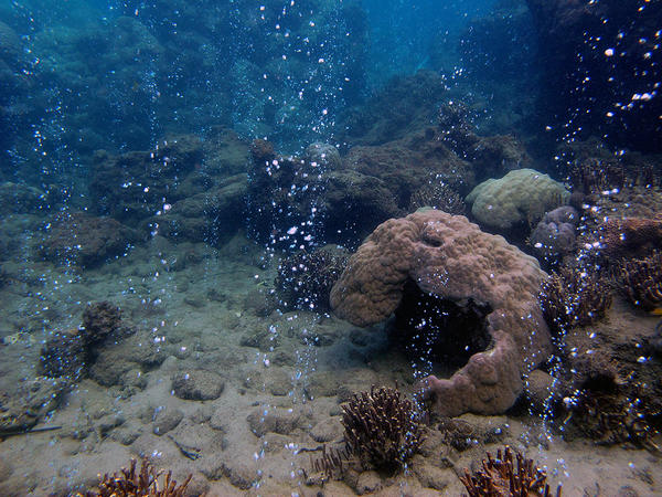
Studies show that rising seas are slowly flooding low-lying areas of dry land along the coast. As its waters creep inland, the Atlantic Ocean is pushing saltwater further upstream into river systems and making coastal marshes even wetter.
Clark Alexander, a researcher at the University of Georgia’s Skidaway Institute of Oceanography in Savannah, and his colleagues are working on a project they hope will more accurately forecast what changes to expect from this encroaching seawater by the year 2100.
What lands will vanish underwater? How much will saltwater seeping further up rivers convert or even destroy freshwater marshes? And how much of Georgia’s nearly 600 square miles of ecologically valuable salt marsh can survive the threat of being drowned by seawater?
“If your marshes are not building up as fast as sea level is rising, you start losing marsh and it converts to open water,” Alexander said. “If we start losing the marshes, then we start losing our healthy crab and shrimp fisheries.”
In addition to providing crucial habitat for plants and animals, salt marshes help buffer coastal communities from hurricane storm surges and filter pollutants from water. And despite having only 100 miles of coast, Georgia is home to roughly one-third of the remaining salt marsh on the East Coast.
To try to predict coastal Georgia’s future, Skidaway Institute scientists plan to use a computer modeling program designed years ago for the U.S. Fish and Wildlife Service. Scientists have been working for the last two years to gather information they need to plug into that program.
First, researchers need to know how far upstream saltwater is already traveling along five coastal river systems — those of the Savannah, Ogeechee, Altamaha, Satilla and St. Marys rivers.
Using a boat equipped with a gadget that pumps water from the river and measures its salt content, scientists have been following the tides upriver and plotting the points where they stop detecting traces of saltwater. Alexander said scientists hope to gather the final data they need from the Altamaha and Satilla rivers in the coming week.
Second, researchers are working to correct errors in marsh elevation as measured by laser-sensing devices that scan the ground from planes and helicopters. Such remote-sensing technology has largely improved the accuracy of topographical maps.
But measurements of marshes are prone to error because lasers can mistake the tops of the tall, dense marsh grasses for the ground. That means the elevation of marshes can be measured an extra 3 feet or higher than they really are.
“These are pretty large errors,” said Christine Hladik, a geography professor at Georgia Southern University who has been working to correct problematic marsh measurements for years.
By measuring different marsh grasses growing in different types of marshes, Hladik has developed a set of “correction factors” that can be subtracted from overly generous marsh measurements to more accurately gauge their elevations.
Once the scientists have the raw information they need to plug into the computer model, it will still take time before they can offer fresh predictions about how rising seas will reshape coastal Georgia.
Alexander said he’s still awaiting funds to finish the project, but hopes to be running new sea-level simulations in the next year.
9(MDAxODM0MDY4MDEyMTY4NDA3MzI3YjkzMw004))

Top Stories