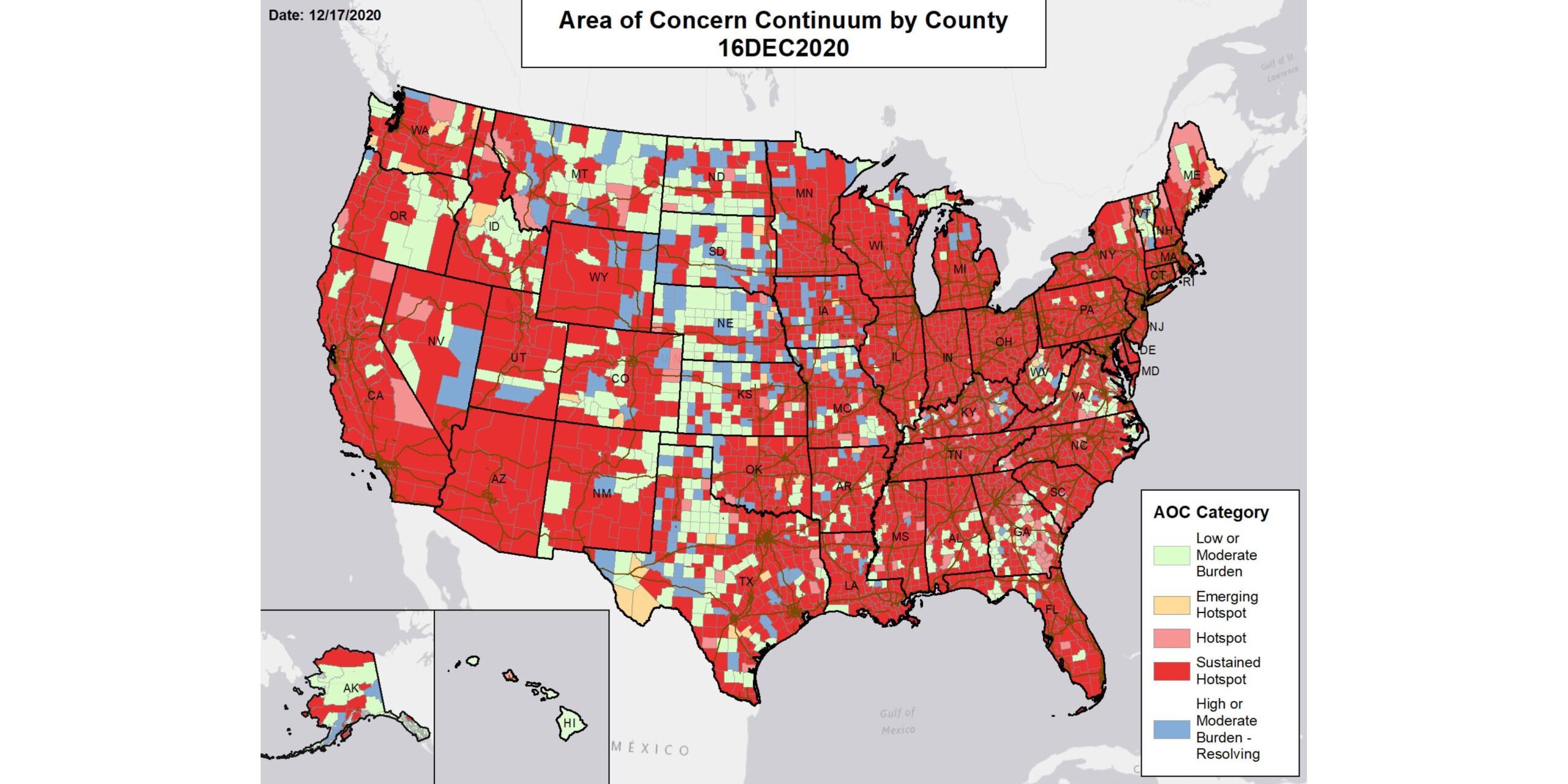
The Trump administration on Friday made public a trove of federal data on the pandemic that reveals a country awash in red alerts.
The data contain a wealth of previously undisclosed information, including counties the federal government considers “hotspots,” forecasts for whether virus cases are likely to increase at a local level, and information on cases, deaths and tests by metro area.
“This will give the American people the same community level information that is available to federal personnel,” wrote federal officials who are responsible for the release of the data and who belong to an interagency group working for the White House Coronavirus Task Force.
Read this story now for free
To continue reading, sign up for our newsletter and get unlimited access to WABE.org
You can select your preferences for news and local content. We will never share your email address. Learn how your newsletter sign-up will support WABE and Public Media