Chattahoochee Plan Envisions Connecting Metro Atlanta With The River

This rendering from the Chattahoochee RiverLands project shows what the project called the Cobb County pilot site education nook.

The Chattahoochee RiverLands

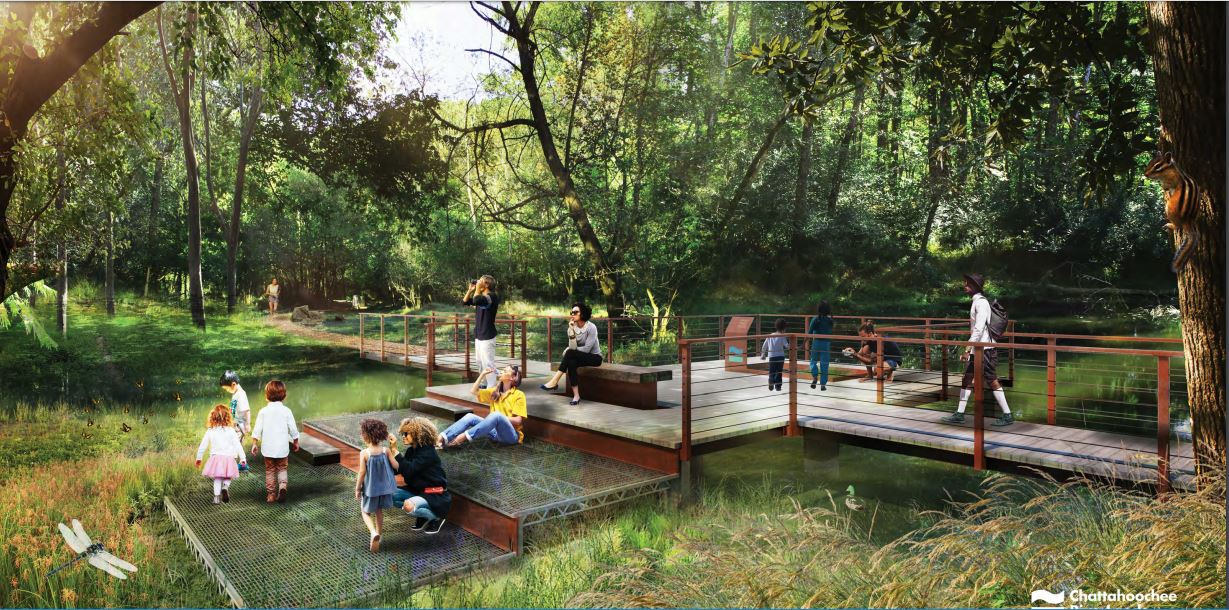
A new plan for the Chattahoochee envisions public access, trails and campsites along more than a hundred miles of the river through metro Atlanta.

From the Buford Dam on Lake Lanier to Chattahoochee Bend State Park in Newnan, the Chattahoochee River flows through seven metro counties and past more than a dozen municipalities.

About a million people live within a 10-minute bike ride of the river, according to Walt Ray with the conservation group Trust For Public Land.

He said while some parts of the Chattahoochee are accessible — in the Chattahoochee River National Recreation Area, for instance — a lot of the river is hard to get to. There are utilities, industrial sites, a lot of private property and Charlie Brown Field.

“We have all these barriers between the population of metro Atlanta and the river,” Ray said.

So the Atlanta Regional Commission, with additional money from Trust for Public Land, the City of Atlanta and Cobb County, paid for a study to put together a vision for a network of trails and public access points. That project, called the Chattahoochee RiverLands, is now complete.

“Equity and equitable community development really emerged as a big topic,” said Byron Rushing with the Regional Commission.

The study helped them see gaps in river access, like relatively few boat ramps in metro Atlanta south of I-20.

“This project is really about reinforcing that the river is a public resource and the public should be able to access and use those spaces,” said Gena Wirth, design principal at SCAPE, which is the landscape architecture firm to put together the plan.

The Chattahoochee RiverLands would include a 125-mile long trail crossing back and forth across the river from Lake Lanier to Chattahoochee Bend State Park. There would be new trails splitting off from the main one to connect to different communities, more than 40 spots to get to the water, places to learn about the history of the area, and places that get conserved for nature.

This is mostly a big idea at this point, without a timeline or anywhere near all the funding. George Dusenbury, the Georgia state director for Trust for Public Land, estimated the whole vision could take $500 million to finish, and it could take decades.

But some places are already working on projects along the river that could eventually be pieces of the whole, including trail and park projects in Johns Creek, Cobb County, Chattahoochee Hills, and Douglas County.

“I’d say within five years, when you say Chattahoochee RiverLands people will know what you’re talking about,” Dusenbury said. “You’ll be able to go visit it and get your feet wet in the water.”