In New Application, Camden Spaceport Proposes Drone Surveillance Of Land, Homes Beneath Rocket Paths

This is a rendering of the original plan for a vertical-launch spaceport in Camden County.

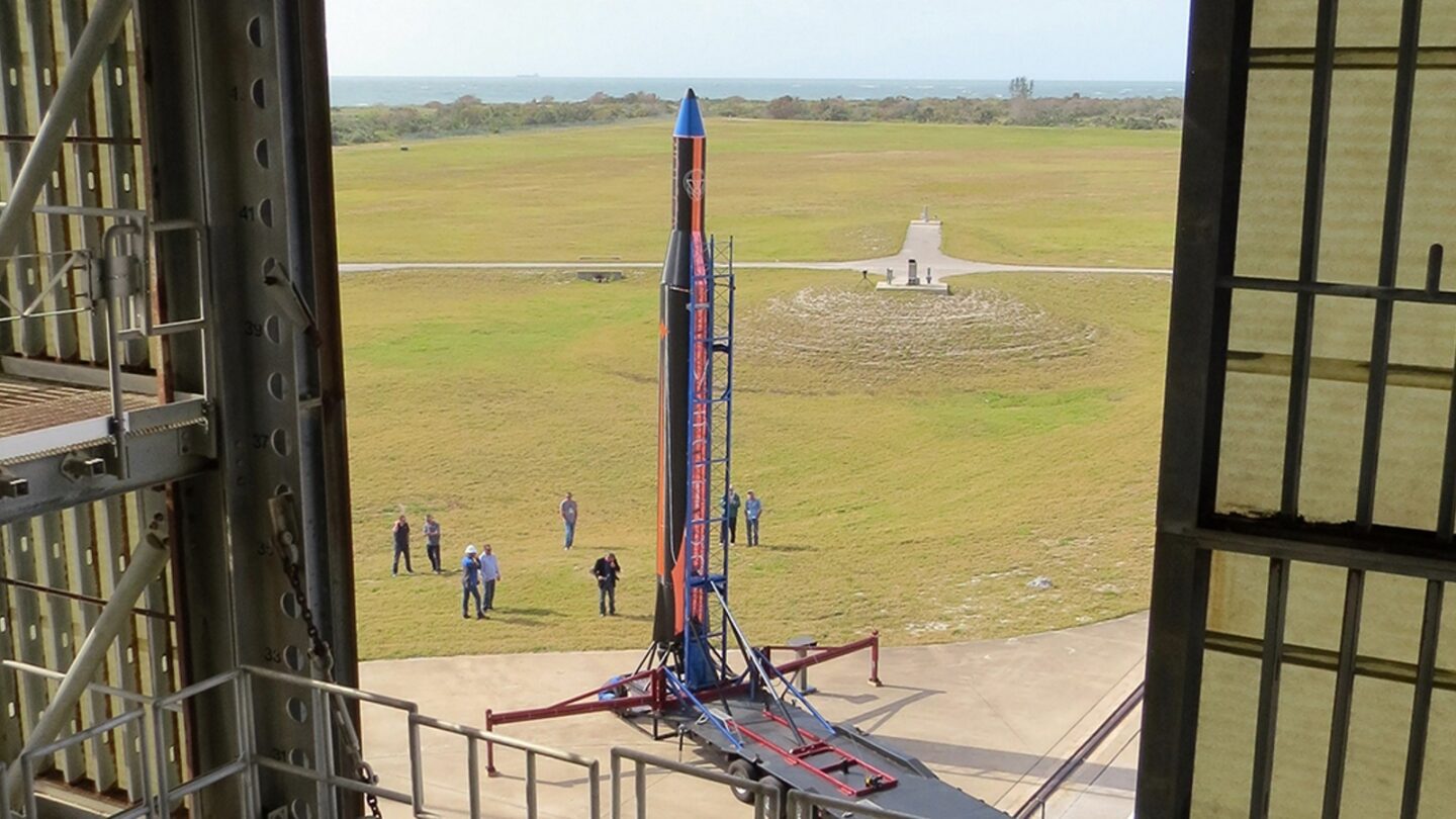
Nearly eight years into its quest to build a spaceport in coastal Georgia, Camden County is proposing the use of drones and aerial surveillance on launch days, as part of a plan to monitor the number of people on private property and in a national park, which lie beneath its proposed rocket trajectories.

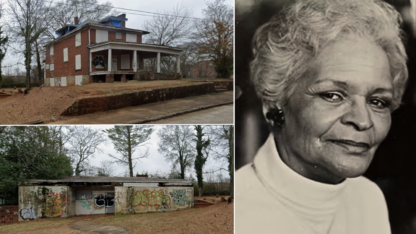
Landowners say they were not consulted about the plans. It exacerbates an already-fraught relationship between the county and, in particular, some private landowners on Little Cumberland over the project.

In its revised launch site operator license application, obtained from the Federal Aviation Administration (FAA) in response to a Freedom of Information Act request, the county also says the new, smaller rockets it plans to launch could fail at least three times more often than its original plan.

A diagram of the population monitoring and management zones Camden County proposes to maintain during rocket launches in its revised launch site operator license application. (Source: Launch Site Operator License Application)

The issue of ensuring the safety of visitors and homeowners on Cumberland Island and Little Cumberland Island has dogged Camden’s proposal for years. No vertical-launch spaceports in the country launch over private homes, and the FAA has asked the county repeatedly how it would work.

Camden submitted an updated application to operate a spaceport for smaller rockets in January after originally proposing to launch medium-to-large rockets. County leaders cited a more favorable market for small launch vehicles as the reason for the last-minute switch.

The county declined a request for an interview about the revised application after being provided a copy of the document WABE is releasing. In a statement, the Board of Commissioners said the county “is not in a position to determine the authenticity of the document” and pointed to the “applicability of a variety of laws explicitly protecting the information contained in the Application from public disclosure.”

“There’s no guarantee in anything. There’s risk in doing something and risk in doing nothing,” said Camden County Administrator Steve Howard about the project in a January interview. “And that’s why the board is looking at this as a potential opportunity.”

“It’s important to me, it’s important to us as well to build for the future to make sure our citizens have opportunities,” he said.

The county has invested more than $8 million on the proposal in an effort to create a new industry and jobs in Camden County by way of a commercial vertical-launch spaceport. A spaceport site operator license does not allow rockets to launch; proposed launches by rocket companies would each need to be subsequently licensed by the FAA.

‘People Don’t Come Here Expecting To Be Spied On With Drones’

In the population monitoring and management plan in the revised application, the county proposes to track visitors to Cumberland Island National Seashore on launch days through the National Park Service’s existing public ferry and camping reservation system.

But there are also private homes with residents and visitors on Cumberland, as well as private boaters who land on the beaches, who are not tracked by the park service. The county proposes to monitor private arrivals to Cumberland through Camden County first responders, National Park Service rangers, and “if necessary, fixed wing and drone aircraft operating under FAA regulations.”

Unmanned aircraft are generally prohibited in the National Park System, except when “approved in writing” by the agency.

Carol Ruckdeschel lives on Cumberland Island. She said she was not consulted about the plans and isn’t aware of any other residents being consulted.

[advert]

“It seems like it’s an incredible burden on the park service but also an incredible imposition on the wilderness area. People don’t come here expecting to be spied on with drones, airplanes, personnel, checkpoints and things like that.”

“As a Camden County taxpayer, I’m not happy about it,” she said. “We’re all footing the bill for this folly.”

Jill Hamilton-Anderson, spokeswoman for the Cumberland Island National Seashore, declined to comment on the plans because the agency had not yet received a copy of the revised application at this stage in the process. In previous comments to the FAA, the agency has been critical of the project’s original proposal.

On Little Cumberland Island, which is privately owned, the county proposes to count the number of owners and visitors present on a launch day through the island homeowners association’s on-site caretaker. Additionally, the county proposes to monitor Little Cumberland visitation through “shore-based video surveillance (and if employed, drone and/or fixed wing aircraft).”

Kevin Lang, vice president of the Little Cumberland Homes Association, confirmed landowners were not consulted about the details in advance of the application. He said the plan is “a little invasive and it’s pretty surreal to read in the application that that’s how they intend to treat our community.”

“I’m not aware of any local government anywhere in our country that deploys these type of methods to try to verify the population of a particular area or where people are,” Lang said.

“I believe it’s unprecedented. Of course, it’s also unprecedented to launch rockets over a residential community as well, so this project has a lot of unprecedented elements to it.”

“I think the question would be, why won’t folks work with us to help us?” said Howard, Camden’s administrator, in January about the protests of some Little Cumberland Island homeowners. “And that’s kind of what I think the question should be. Why wouldn’t you help prosperity for a community? Why wouldn’t you be able to do this 12 times a year? Why couldn’t you do it? And I think those are things you’d have to look at. And nobody’s taking anybody’s property.”

Edward Ellegood, a space policy analyst who helped found and develop what is now Space Florida at Cape Canaveral, said there’s no precedent that he’s aware of in the United States for surveillance of private property during launches, nor any American precedent for homes beneath rocket trajectories.

“Maybe the best corollary would be what China’s doing,” he said. “At their Xichang spaceport, entire villages are located downrange. Their spent rocket stages routinely fall near populated areas, sometimes destroying homes and private property.”

[advert]

Ellegood said Camden’s proposal would create a difficult situation for both residents and launch operators. And launching rockets is not easy to begin with. He pointed to Astra, a California startup that’s struggled recently to hold its first successful launch at Pacific Spaceport Complex in Alaska. “They’ve had problem after problem trying to overcome technical issues, weather issues, issues with the range and issues with the spaceport infrastructure itself,” he said.

“Imagine if there were homes downrange and the repeated restrictions that would be put on those homes, and then imagine how people not obeying those restrictions might impact the launch operation,” he said.

Camden County’s plans also include closure of waters near the site. Boats would need “pre-authorization as a property owner or registered guests of an owner” in order to pass through the “Safety Zone” maintained by the U.S. Coast Guard on a launch day.

Closing public waterways is common for coastal spaceports around the country, and several launches have been scrubbed because of wayward boats in closed downrange waters, including one of Astra’s in Alaska earlier this month.

In 2018, several local fishermen testified in Camden about the negative effect closing those waters for commercial space activity would have on their businesses.

‘How Do You Determine A Risk Factor?’

When conducting a safety analysis of Camden’s proposed trajectories in 2018, an FAA engineer pointed out that a smaller vehicle would reduce a casualty area, but that those smaller rockets could be less reliable and have a higher probability of failure.

In its revised application addressing safety, the county tripled the probability of rocket failure to 20% for smaller rockets, from the original range of 2.5% to 6% for medium-to-large launch vehicles.

When asked about this increased failure rate for smaller rockets in January, as compared to the county’s original proposal, Howard with Camden County suggested to WABE the FAA emails were outdated.

“We want a mature rocket launching from Spaceport Camden. But let’s not forget the whole reason behind this project,” he continued. “It’s really not about launching. That’s the catalyst, but you want everything else around it: STEM programs, educational programs, manufacturing, all those kinds of things.”

The county proposes up to 12 launches per year, with up to an additional 42 wet dress and static fire engine tests. A 20% failure rate would equate to at least two of those launches per year.

[advert]

In its calculation of risk for the uninvolved public beneath the proposed rocket paths, which is required by the FAA’s licensing process, the county outlined a “conservative” estimate of population present on the islands.  Per Camden’s calculations, their proposed launches would pass the FAA’s safety regulations. Launches, by Camden’s calculations, would only exceed the level of risk to the general public prohibited by the federal government in the uninhabited marsh nearest to the proposed spaceport site.

But the plan is still problematic, argued Brian Gist, senior attorney with the Southern Environmental Law Center, which has advocated against the proposal on environmental and good governance grounds.

“What they’re trying to do is make the numbers work while trying to launch rockets over a downrange community,” he said.

“The formula is intended to calculate a certain degree of risk. But whether it’s one person in a house or 40 people in a house, if that house is hit by debris from a rocket, that’s still going to be a terrible outcome for that person or those people.”

“How do you determine a risk factor?” asked Ruckdeschel. “Seems like one person would be too many. There’s a lot I don’t understand about [the proposal] at all.”

Fire Mitigation

Another section of Camden County’s revised application, which was expressly requested by the FAA, is its plan to fight potential fires caused by rocket debris on Little Cumberland Island.

The county proposes using specially equipped ATVs, which would land on Little Cumberland beaches in the event of a fire, and explained it is also repairing a water buffalo for the island to contribute to the mitigation efforts. The county predicts that with these ATVs pre-staged in the water they would be able to reach any area of the island within 15 to 30 minutes.

Lang of the island’s homeowners association, calls the plan “completely inadequate.”

(Source: Launch Site Operator License Application)
The rocket launch trajectories proposed by the Spaceport Camden project, which fly over Little Cumberland and Cumberland Islands. (Source: Launch Site Operator License Application)

“You’re not going to be able to get there quickly enough,” he said. “And when you’re there, there are parts of the island that are only accessible by foot. You can’t get machinery of any significant size in to fight the fire. You’re not going to be able to mobilize enough via the air to get enough water on a multi-point fire.”

He pointed out that vehicles are only able to access the island from the beaches in a few places because of a bluff around its exterior, and, while it has a trail system, most of the island remains inaccessible.

Lang said there’s been “absolutely no communication” between the county and Little Cumberland about the plans in the application that involve the island.

“We know our island better than they know our island. And for them not to engage with us at all and to develop this mitigation plan is pretty amazing.”

“The lack of transparency has allowed this project to exist for five years,” Lang argued. “If Camden County had actually revealed to the public what’s going on with this project and been evenhanded that launching rockets is very unlikely, then the support for this project would melt away.”

Gist, with the Southern Environmental Law Center, also decried the lack of transparency about the project throughout the process. His organization has settled a lawsuit with the FAA about unfilled Freedom of Information Act requests related to the spaceport, and sued the county on behalf of One Hundred Miles environmental group over alleged Georgia Open Records Act violations.

“This project is an example of why open records laws exist,” he said.

“The public shouldn’t have to jump through a bunch of hoops to figure out basic information about a project when that information deals with things like risk of bodily harm, risk to their property, government management of private property. Those are things that the public should have access to and has a right to know.”