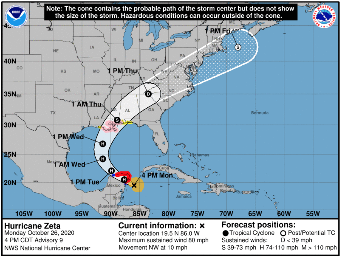
Zeta has officially strengthened into a hurricane, and is predicted to make landfall late Monday on Mexico’s Yucatan Peninsula before setting its sights on the U.S.
Louisiana is directly in the path of Hurricane Zeta, which is expected to make landfall there on Wednesday night. If it does so, it would be the fifth named storm to make landfall in the state during a single year — the highest number since the state started keeping records in 1851, state climatologist Barry Keim told The Times-Picayune. (A few other storms have crossed into Louisiana after making landfall in other states.)
Gov. John Bel Edwards has declared a state of emergency in advance of the hurricane. The storm is currently expected to bring 2-4 inches of rain across southeast Louisiana, but the greatest threat will come from high winds, Edwards said Monday.
“The good thing, and the bad thing at the same time, is we’ve had a lot of practice this year” dealing with storms, Edwards said. The Federal Emergency Management Agency and National Guard have people on the ground ready to help once the storm hits, he said.
Louisianans are suffering from hurricane fatigue. The state still hasn’t fully recovered from Hurricanes Laura and Delta. More than 3,500 people are still in shelters after the devastation wrought by Laura and Delta, Edwards said.

9(MDAxODM0MDY4MDEyMTY4NDA3MzI3YjkzMw004))


