GA group helps turn unused roadsides into solar fields

Along I-85 in West Georgia, previously vacant land now hosts 2,600 solar panels generating one megawatt of electricity, enough to power about 100 homes. (Photo credit: Emily Jones)

This coverage is made possible through a partnership with WABE and Grist, a nonprofit, independent media organization dedicated to telling stories of climate solutions and a just future.

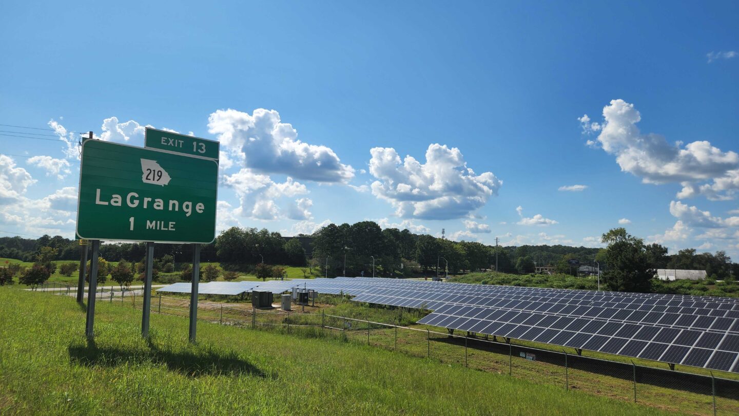
When Harriet Anderson Langford and Allie Kelly drive the stretch of I-85 in West Georgia known as the Ray C. Anderson Memorial Highway, they see plenty of their own handiwork to admire.

The highway is named for Langford’s dad, Ray Anderson, the founder of carpet manufacturer Interface and an advocate for sustainability. The nonprofit made in his honor, called the Ray, works to make the road more sustainable, with pollinator-friendly wildflowers on the roadside, longer-lasting rubberized pavement, and at one exit, solar panels.

“This used to be a completely cleared five acre triangle of roadside at exit 14 on Interstate 85,” Kelly, the Ray’s executive director, explained. “It was unsightly and it was eroding. And what it is today is a field of clean green energy.” 

The land now hosts 2,600 solar panels that generate one megawatt of electricity for Georgia Power’s grid – enough to power just over 100 homes. The panels stand a bit taller than most solar fields to allow wildflowers to grow underneath.

“The landscape has totally changed due to the public-private partnership that brings green energy to life on what was underutilized and kind of wasted public land,” Kelly said.

Acres and acres of land like this line every highway in Georgia and across the country: in the medians, beside the shoulders, in the big loops made by on- and off-ramps. As transportation departments across the country work to reduce their emissions, many are considering solar on their unused land. 

But that can be daunting, so the Ray and mapping company ESRI made a digital tool to help.

Eddie Lukemire of the Maryland DOT’s office of environment is working on ways to use solar to meet that state’s ambitious goal of net-zero emissions by 2045. But the state has some 3,000 parcels of land along its highways.

“So when you look at 3,000 rows in an Excel spreadsheet, and then you uncross your eyes, those are just numbers,” he said. “I don’t have a column that says, are there trees on that parcel, because we don’t want to cut any trees down to put solar there.”

The Ray’s tool finds the parcels of land where solar would work best. Planners can make a virtual mock-up to make sure the installation doesn’t block a view or sit too close to the road. MDOT hasn’t formally adopted the tool, but Lukemire said it would be useful.

“It’s really cool to be able to put that jumble of numbers into a program and have an output that is understandable by me, you, anyone that I want to show it to and say, ‘Look, this is what we want to do,’” he said.

Along with narrowing down parcels of land and providing a visual model, the tool can translate a proposed solar project into whatever terms make most sense, whether that’s homes powered, economic value or carbon offsets. 

“Delay is death for projects,” Kelly said. “We are talking about tools that carry project concepts over the valley of death, to procurement and to planning.”

The mapping tool is free, and Kelly said the Ray is working with more than two dozen states to find potential solar sites. Several of those states have carbon emission reduction goals like Maryland does. 

Oregon, for instance, had stopped developing highway solar despite installing two of the country’s first projects in 2008 and 2012. But an executive order from the state’s governor calling for 80 percent reduction in greenhouse gas emissions by 2050 has kickstarted the program. Now, the Oregon DOT is developing new solar projects, using the Ray’s tool.

Here in Georgia, there aren’t climate requirements like Maryland’s and Oregon’s. And there aren’t currently plans for more roadside solar beyond the installation on the Ray. 

John Hibbard of GDOT explained that most of the agency’s unused land parcels are around five to seven acres, the same size as that existing one-megawatt solar installation.

“One megawatt, which sounds like a lot, really isn’t that much,” he said. “It’s good, it’s better than zero. But it doesn’t compare with hundreds or thousands of megawatts.”

The state’s largest utility, Georgia Power, has prioritized bigger solar projects – huge fields of solar panels that can generate upwards of 100 megawatts.

Ray founder Harriet Anderson Langford said the small solar array is part of a broader project: to showcase ways to make a road full of cars more sustainable.

“We hope what we do is inspiring to some other places,” Langford said. “That’s our goal.”

All told, the Ray estimates there are more than 52,000 acres of empty roadside land in the continental US that could be generating solar power.